GIS_GEOMETRY: Building a JSON Geometry Object
|
How to: |
The GIS_GEOMETRY function builds a JSON Geometry object given a geometry type, WKID, and a geometry.
Syntax: How to Build a JSON Geometry Object
GIS_GEOMETRY(geotype, wkid, geometry)
where:
- geotype
-
Alphanumeric
Is a geometry type, for example, 'esriGeometryPolygon' ,esriGeometryPolyline, 'esriGeometryMultipoint', 'EsriGeometryPoint', 'EsriGeometryExtent'..
- wkid
-
Alphanumeric
Is a valid spatial reference ID. WKID is an abbreviation for Well-Known ID, which identifies a projected or geographic coordinate system.
- geometry
-
TX
A geometry in JSON.
The output is returned as TX.
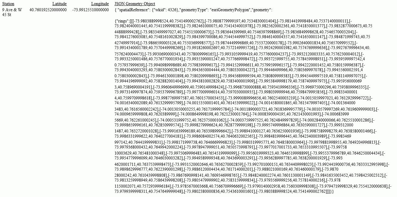
Example: Building a JSON Geometry Object
The following request builds a polygon geometry of the area encompassing ZIP code 10036 in Manhattan. The input geometry object is stored in a text (.ftm) file that is cross-referenced in the esri-citibike Master File. The field containing the geometry object is GEOMETRY.
DEFINE FILE esri/esri-citibike
WKID/A10  = '4326';
 MASTER_GEOMETRY/TX256 (GEOGRAPHIC_ROLE=GEOMETRY_AREA) =
    GIS_GEOMETRY( 'esriGeometryPolygon', WKID , GEOMETRY );
END
TABLE FILE esri/esri-citibike
 PRINT
    START_STATION_NAME AS Station
    START_STATION_LATITUDE AS Latitude
    START_STATION_LONGITUDE AS Longitude
    MASTER_GEOMETRY AS 'JSON Geometry Object'
 WHERE START_STATION_ID EQ 479
ON TABLE SET PAGE NOLEAD
 ON TABLE SET STYLE *
type=report, grid=off, size=10,$
 ENDSTYLE
END
The output is shown in the following image.
| WebFOCUS | |
|
Feedback |