Using an Esri Vector Basemap as a Base Layer
Basemaps that are not vector maps are pre-rendered image tiles. Vector basemaps are delivered from ArcGIS Online as vector tiles that are rendered on the client based on a style file that is delivered with the vector tiles. This provides customization options not available with pre-rendered image tiles.
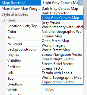
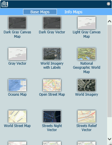
A default set of vector basemaps is available for selection in the Properties panel for an Esri map, as shown in the following image.
You can add additional vector basemaps using the Reporting Server GEO configuration editor.
The default vector basemaps are:
- Dark Gray Vector. Provides a detailed basemap for the world, with a dark neutral background using minimal colors, labels, and features.
- Gray Vector. Provides a detailed basemap for the world, with a light neutral background using minimal colors, labels, and features.
- Streets Navigation Vector. Provides a detailed basemap for the world, with a custom navigation map style.
- Streets Night Vector. Provides a detailed vector basemap for the world, using a custom night time street map style that is designed for use at night or in other low-light environments.
- Streets Relief Vector. Provides a detailed vector basemap for the world, using a classic Esri street map style including a relief map.
- Streets Vector. Provides a detailed vector basemap for the world with a classic Esri street map style.
- Topographic Vector. Provides a detailed basemap for the world, symbolized with a classic Esri topographic map style.
Example: Using a Vector Basemap as a Base Layer
The following request is named customer_locations.fex.
TABLE FILE WF_RETAIL_LITE
PRINT
ID_CUSTOMER
COGS_US
QUANTITY_SOLD
COMPUTE LONGITUDE/D12.2 =CUSTOMER_LONGITUDE;
COMPUTE LATITUDE/D12.2 = CUSTOMER_LATITUDE;
BY STATE_PROV_NAME
BY ID_CUSTOMER NOPRINT
WHERE COUNTRY_NAME EQ 'United States';
ON TABLE NOTOTAL
ON TABLE PCHOLD FORMAT XML
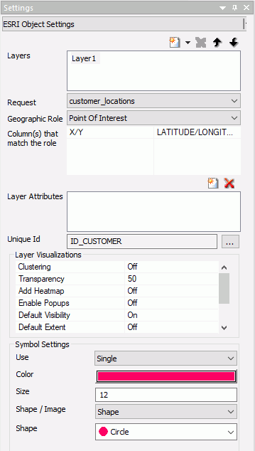
ENDThe Settings panel for an HTML page with an Esri component that uses this request is shown in the following image.
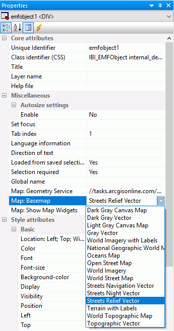
In the Map: Basemap property of the Properties panel, Streets Relief Vector is selected, as shown in the following image.
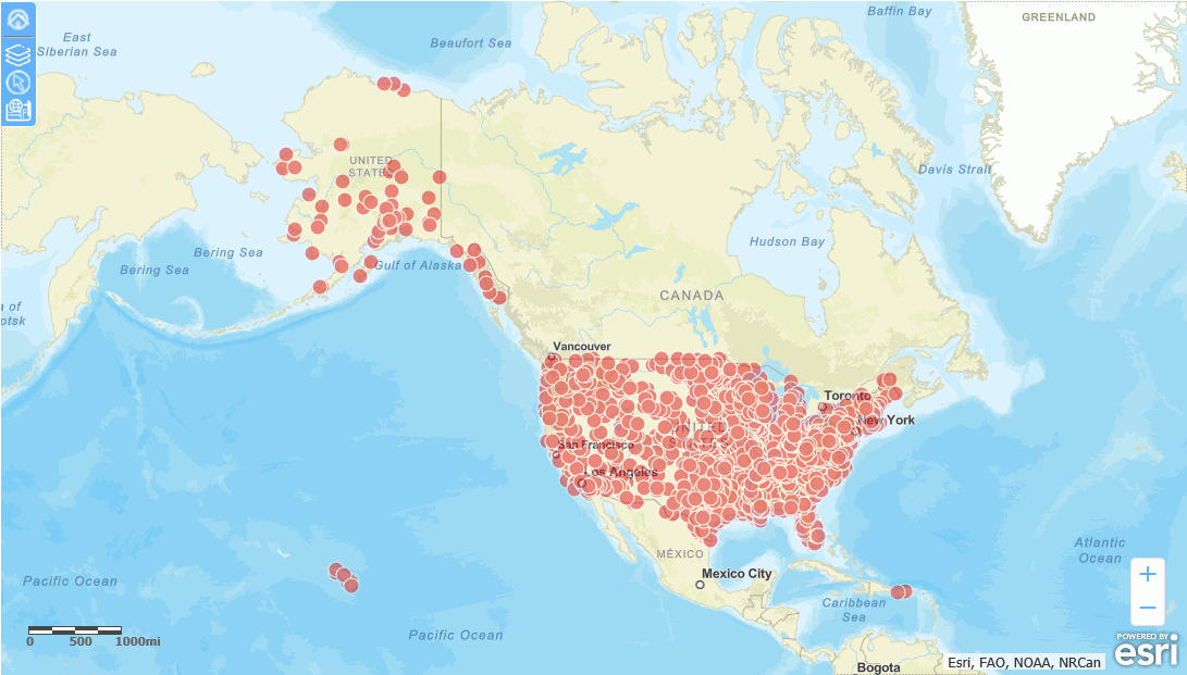
Running the HTML page generates the output shown in the following image.
The vector basemaps are also available in the Change Basemap widget, as shown in the following image.
For information on custom vector basemaps, see Configuring a Custom Vector Basemap.
| WebFOCUS | |
|
Feedback |