Styling Point Clusters on Esri Maps
Turning the Clustering layer visualization on for a point map combines multiple points into one symbol, with default class breaks, colors, and sizes. You can style the clusters by changing the default colors, sizes, and class breaks. The only symbol shape supported for clustering is a circle.
The default clusters are broken into three classes.
- Class 1 clusters 0 to 10 points using a 20px diameter symbol with blue fill.
- Class 2 clusters 11 to 200 points using a 35px diameter symbol with green fill.
- Class 3 clusters more than 200 points using a 60px diameter symbol with red fill.
When you turn the Clustering layer visualization on in the Settings panel for a map, a dialog box opens that enables you to customize the number of classes and the colors and sizes for each class, as shown in the following image.
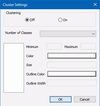
To customize the symbols, enter the following information in the Cluster Settings dialog box.
- Click On in the Clustering section.
- Select a number of classes, between 2 and 5, from the Number of Classes drop-down list.
The class numbers are added to the list box on the left of the dialog box, as shown in the following image, where the number 3 was selected.
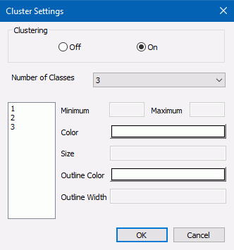
- Click each class number. The following properties become active for each class.
- Minimum. Specifies the smallest number of features (records) at any given map scale. Enter the smallest number of points you want to include in this class.
- Maximum. Specifies the largest number of features (records) at any given map
scale.
Enter the largest number of points you want to include in this class.
Note: The minimum value for each class must be less than its maximum value.
- Size. Represents the maximum symbol size (in pixels) that corresponds to this scale. Enter the maximum symbol size you want to use for this class.
- Color. Represents the color that will be used for coloring the inner circle. Click this box to open the color picker dialog box and select a color.
- Outline Color. Represents the color that will be used for coloring the outer circle. Click this box to open the color picker dialog box and select a color.
- Outline Width. Represents the width of the outer circle in pixels. Enter a number of pixels in this text box.
- Click OK.
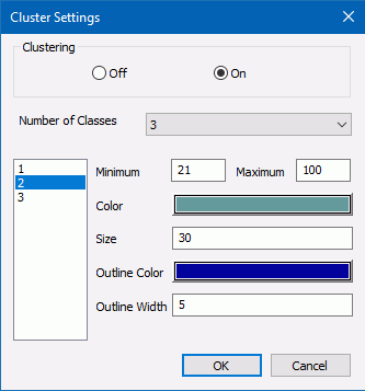
The following image shows sample customized properties for Class 2.

When you run the HTML page, you will see the customized clusters.
Example: Customizing Point Clusters on an Esri Map
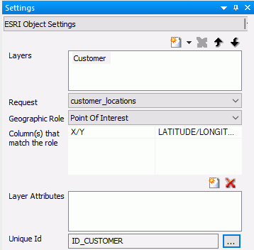
Create an HTML page with an Esri component. Add the following request, named customer_locations.fex, in the folder with the HTML page, then add it to the HTML page using the Requests & Data Sources panel.
TABLE FILE WF_RETAIL_LITE
PRINT
     ID_CUSTOMER
     COGS_US
	    QUANTITY_SOLD
     COMPUTE LONGITUDE/D12.2 =CUSTOMER_LONGITUDE;
     COMPUTE LATITUDE/D12.2 = CUSTOMER_LATITUDE;
BY  STATE_PROV_NAME
BY  ID_CUSTOMER NOPRINT
WHERE COUNTRY_NAME EQ 'United States';
ON TABLE NOTOTAL
ON TABLE PCHOLD FORMAT XML
END
In the Settings panel, select this request, select the Point of Interest Geographic Role, and select ID_CUSTOMER as the Unique Id field, as shown in the following image.
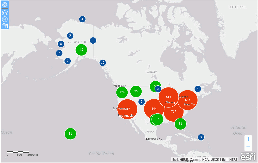
In the Layer Visualizations section of the Settings panel, click Clustering. Click the On radio button.
Click OK and run the HTML page. The clusters appear with the default properties, as shown in the following image.
In the Layer Visualizations section of the Settings panel, click Clustering.
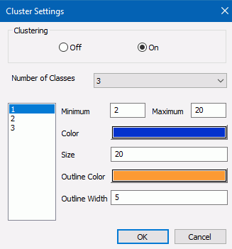
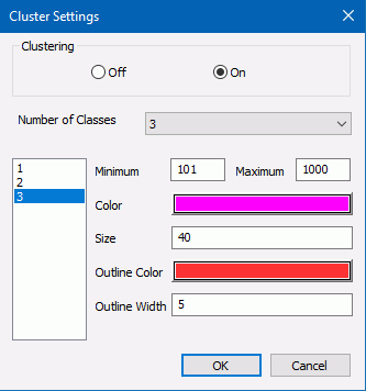
In the Cluster Settings dialog box, turn clustering on and select three classes. Select the options shown in the following images for each class.
Class 1
Class 2
Class 3
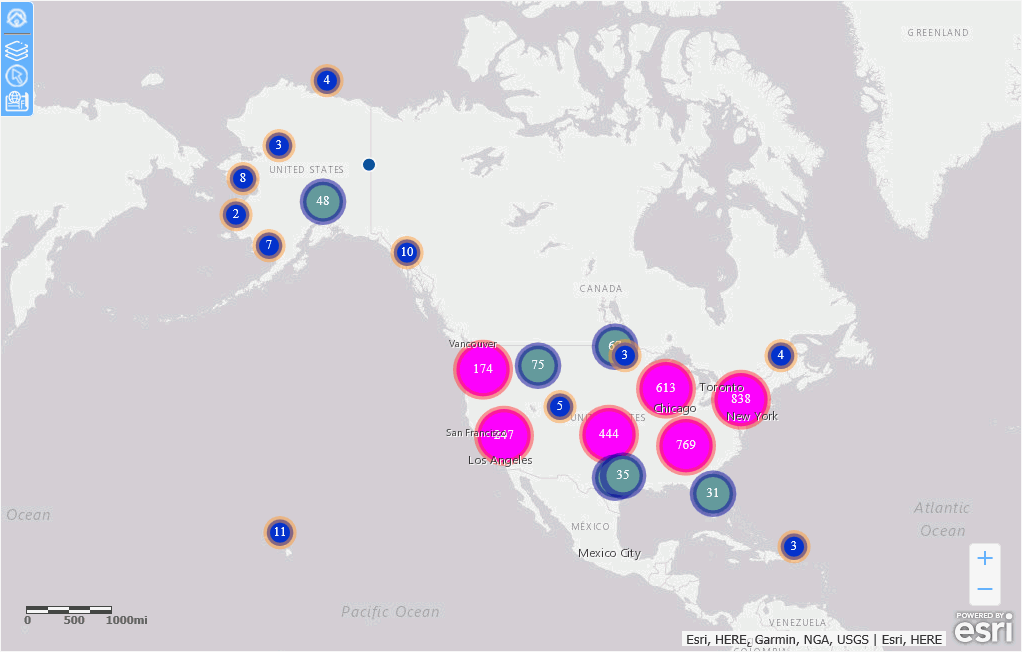
Click OK and run the HTML page. The customized clusters are shown in the following image.
| WebFOCUS | |
|
Feedback |