GIS_SERVICE_AREA: Calculating a Geometry Area Around a Given Point
|
How to: |
The GIS_SERVICE_AREA function uses a GIS service to calculate the geometry area with access boundaries within the given time or distance from the provided geometry point. The output is returned in text format.
Syntax: How to Calculate a Geometry Area Around a Point
GIS_SERVICE_AREA(geo_point, distance, travel_mode)
where:
- geo_point
-
Alphanumeric
Is the starting geometry point.
- distance
-
Alphanumeric
Is the travel limitation in either time or distance units.
- travel_mode
-
Alphanumeric
Is a valid travel mode as defined in gis_serv_area.mas in the Catalog directory under the server installation directory. The accepted travel modes are;
- 'Miles'. This is the default value.
- 'TravelTime'.
- 'TruckTravelTime'.
- 'WalkTime'.
- 'Kilometers'.
Example: Calculating a Service Area Around a Geometry Point
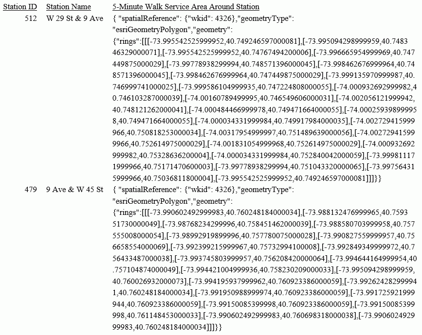
The following request calculates the geometry area that is a five-minute walk around a station.
DEFINE FILE esri/esri-citibike
WKID/A10='4326';
START_STATION_POINT/A200=GIS_POINT(WKID, START_STATION_LONGITUDE, START_STATION_LATITUDE);
DISTANCE/A10='5';
TRAVEL_MODE/A10='WalkTime';
STATION_SERVICE_AREA/TX80 (GEOGRAPHIC_ROLE=GEOMETRY_AREA)=
 GIS_SERVICE_AREA(START_STATION_POINT, DISTANCE, TRAVEL_MODE);
END
TABLE FILE esri/esri-citibike
 PRINT
    START_STATION_ID AS 'Station ID'
    START_STATION_NAME AS 'Station Name'
    STATION_SERVICE_AREA AS '5-Minute Walk Service Area Around Station'
 WHERE START_STATION_ID EQ 479 OR 512;
ON TABLE SET PAGE NOLEAD
ON TABLE SET STYLE *
TYPE=REPORT, GRID=OFF, SIZE=12,$
ENDSTYLE
END
The output is shown in the following image.
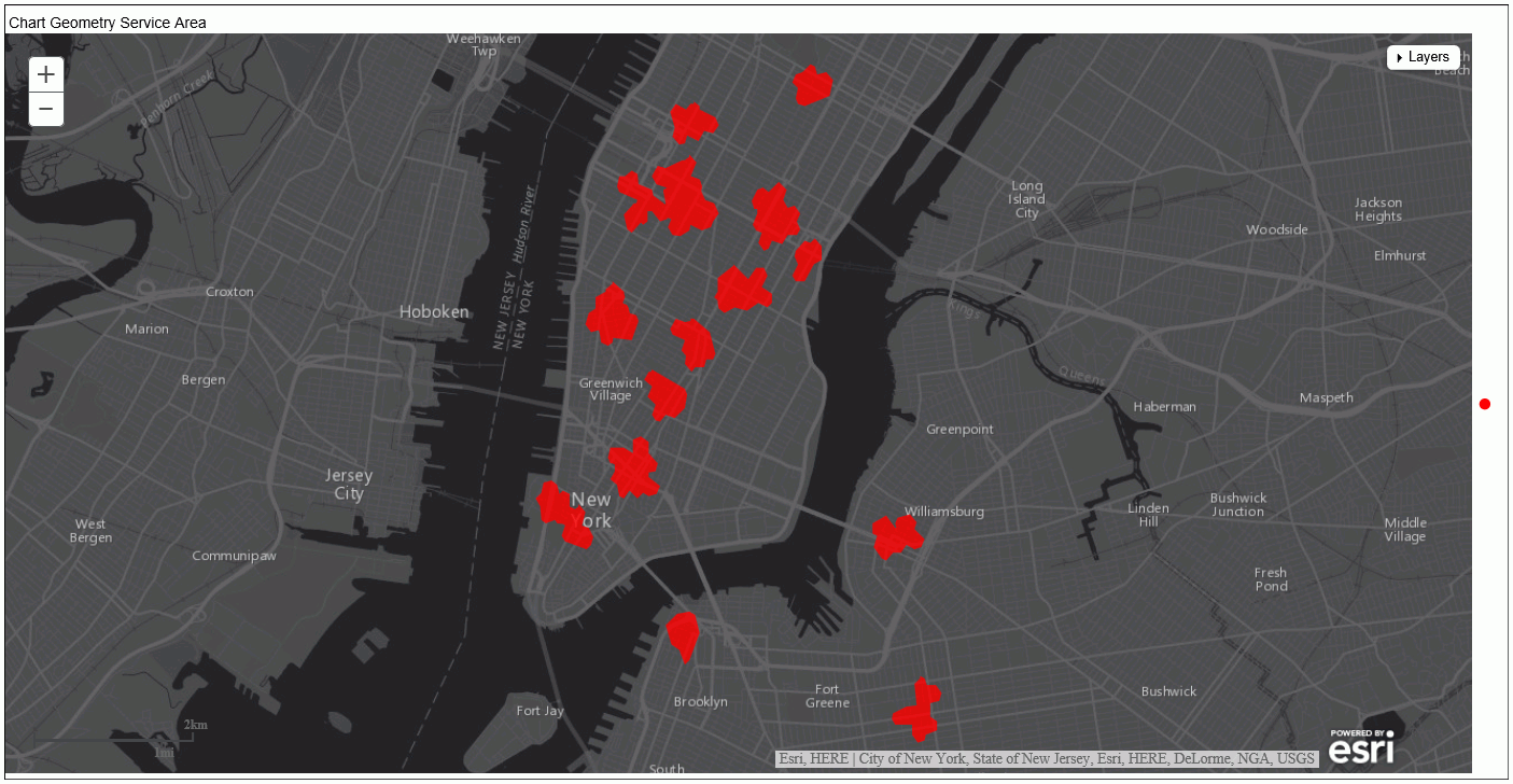
Example: Charting a Geometry Service Area Around a Point
The following request generates service areas that are 5-minute walking distances from start station geometry points and charts them on an Esri map.
DEFINE FILE esri-citibike
WKID/A10='4326';
START_STATION_POINT/A200=GIS_POINT(WKID, START_STATION_LONGITUDE, START_STATION_LATITUDE);
DISTANCE/A10='5';
TRAVEL_MODE/A10='WalkTime';
STATION_SERVICE_AREA/TX80 (GEOGRAPHIC_ROLE=GEOMETRY_AREA)=
 GIS_SERVICE_AREA(START_STATION_POINT, DISTANCE, TRAVEL_MODE);
END
GRAPH FILE ESRI-CITIBIKE
 PRINT
   START_STATION_NAME
   END_STATION_NAME
   DISTANCE
 ON TABLE PCHOLD FORMAT JSCHART
 ON TABLE SET LOOKGRAPH CHOROPLETH
 ON TABLE SET EMBEDHEADING ON
 ON TABLE SET AUTOFIT ON
 ON TABLE SET STYLE *
  TYPE=REPORT, TITLETEXT='Map', PAGESIZE=E, CHART-LOOK=com.esri.map, $
  TYPE=DATA, COLUMN=N1, /*START_STATION_NAME*/
   BUCKET=tooltip, $
  TYPE=DATA, COLUMN=N2, /*END_STATION_NAME*/
   BUCKET=tooltip, $
  TYPE=DATA, COLUMN=N3, /*DISTANCE*/
   BUCKET=tooltip, $
  *GRAPH_JS_FINAL
"legend": {"visible": true},
"extensions" : { "com.esri.map" :
  { "scalebar" :
{
    "scalebarUnit": "dual",
    "attachTo" : "bottom-left"
  },
  "baseMapInfo": {
       "drawBasemapControl" : false,
       "showArcGISBasemaps" : false,
            "customBaseMaps" : [
            {"ibiBaseLayer" : "dark-gray"}
        ]
   },
  "overlayLayers":
  [{
  "ibiDataLayer": {"map-geometry" :  {"map_by_field" : "STATION_SERVICE_AREA"}}, "title" : "Chart"}]
  },
"introAnimation": "{\"enabled\":false}"
}

  *END
 ENDSTYLE
 HEADING
  "Chart Geometry Service Area"
END
The output is shown in the following image.
| WebFOCUS | |
|
Feedback |